
Worlingham topographic map
Click on the map to display elevation.
About this map
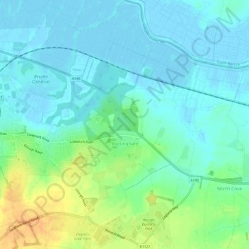
Name: Worlingham topographic map, elevation, terrain.
Location: Worlingham, East Suffolk, Suffolk, England, United Kingdom (52.43606 1.57635 52.47221 1.61779)
Average elevation: 10 m
Minimum elevation: -2 m
Maximum elevation: 36 m
Other topographic maps
Click on a map to view its topography, its elevation and its terrain.