
Donji grad topographic map
Interactive map
Click on the map to display elevation.
About this map
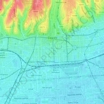
Name: Donji grad topographic map, elevation, terrain.
Location: Donji grad, Zagreb, Ville de Zagreb, 10000, Croatie (45.80232 15.95698 45.81478 16.00377)
Average elevation: 132 m
Minimum elevation: 112 m
Maximum elevation: 195 m
Other topographic maps
Click on a map to view its topography, its elevation and its terrain.