
Thank you for supporting this site ❤️
Make a donation
Make a donation
Shannan topographic map
Click on the map to display elevation.
Thank you for supporting this site ❤️
Make a donation
Make a donation
Shannan
Shannan has 1 district and 11 counties and its capital is Tsetang, which is located 183 kilometres from Lhasa. It covers an area of 79,700 square kilometres (30,800 sq mi), which includes part of South Tibet, a disputed territory currently under control of the Indian state of Arunachal Pradesh. Its topography averages 3,700 metres (12,100 ft) above sea level. The population of Tsetang city was 330,100 as of 2007 with Tibetans accounting for 96% of the total population.
Thank you for supporting this site ❤️
Make a donation
Make a donation
About this map
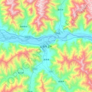
Name: Shannan topographic map, elevation, terrain.
Average elevation: 4,148 m
Minimum elevation: 3,542 m
Maximum elevation: 5,430 m
Thank you for supporting this site ❤️
Make a donation
Make a donation