
Kisoro topographic map
Interactive map
Click on the map to display elevation.
About this map
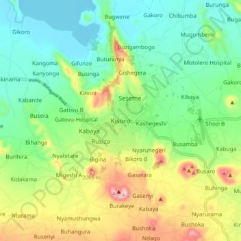
Name: Kisoro topographic map, elevation, terrain.
Location: Kisoro, Cyanika, Kisoro, West-Region, Uganda (-1.32221 29.65267 -1.24221 29.73267)
Average elevation: 1,911 m
Minimum elevation: 1,781 m
Maximum elevation: 2,170 m