
Midden-Drenthe topographic map
Interactive map
Click on the map to display elevation.
About this map
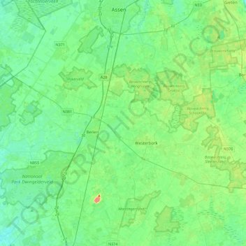
Name: Midden-Drenthe topographic map, elevation, terrain.
Location: Midden-Drenthe, Drenthe, Pays-Bas (52.73569 6.35954 53.00541 6.72863)
Average elevation: 15 m
Minimum elevation: 3 m
Maximum elevation: 50 m
Other topographic maps
Click on a map to view its topography, its elevation and its terrain.