
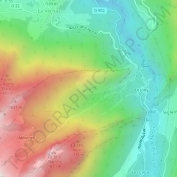
Jotty topographic map
Interactive map
Click on the map to display elevation.
About this map
Name: Jotty topographic map, elevation, terrain.
Average elevation: 1,005 m
Minimum elevation: 573 m
Maximum elevation: 1,690 m
Other topographic maps
Click on a map to view its topography, its elevation and its terrain.
Le Gerdil
France > Auvergne-Rhône-Alpes > Haute-Savoie > La Vernaz > Le Gerdil
Le Gerdil, La Vernaz, Thonon-les-Bains, Haute-Savoie, Auvergne-Rhône-Alpes, France métropolitaine, 74200, France
Average elevation: 811 m
Le Jotty
France > Auvergne-Rhône-Alpes > Haute-Savoie > La Vernaz
Le Jotty, La Vernaz, Thonon-les-Bains, Haute-Savoie, Auvergne-Rhône-Alpes, France métropolitaine, 74200, France
Average elevation: 1,063 m