Wallenfels topographic map
Interactive map
Click on the map to display elevation.
About this map
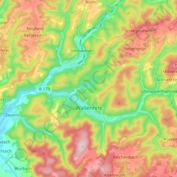
Name: Wallenfels topographic map, elevation, terrain.
Location: Wallenfels, Landkreis Kronach, Bayern, 96346, Deutschland (50.23312 11.43329 50.32514 11.56620)
Average elevation: 500 m
Minimum elevation: 332 m
Maximum elevation: 711 m
Other topographic maps
Click on a map to view its topography, its elevation and its terrain.
96349
Deutschland > Bayern > Landkreis Kronach > Steinwiesen
96349, Steinwiesen, Landkreis Kronach, Bayern, Deutschland
Average elevation: 552 m
Steinwiesen
Deutschland > Bayern > Landkreis Kronach
Steinwiesen, Landkreis Kronach, Bayern, 96349, Deutschland
Average elevation: 516 m
Kronach
Deutschland > Bayern > Landkreis Kronach
Kronach, Landkreis Kronach, Bayern, 96317, Deutschland
Average elevation: 394 m