
Van d'en Haut topographic map
Interactive map
Click on the map to display elevation.
About this map
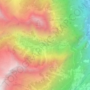
Name: Van d'en Haut topographic map, elevation, terrain.
Location: Van d'en Haut, Salvan, Saint-Maurice, Valais, 1922, Suisse (46.12029 6.98047 46.16029 7.02047)
Average elevation: 1,647 m
Minimum elevation: 453 m
Maximum elevation: 2,687 m
Other topographic maps
Click on a map to view its topography, its elevation and its terrain.