
Thank you for supporting this site ❤️
Make a donation
Make a donation
Luashi topographic map
Click on the map to display elevation.
Thank you for supporting this site ❤️
Make a donation
Make a donation
About this map
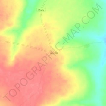
Name: Luashi topographic map, elevation, terrain.
Location: Luashi, Dilolo, Lualaba, Democratic Republic of the Congo (-10.94845 23.58833 -10.90845 23.62833)
Average elevation: 1,228 m
Minimum elevation: 1,186 m
Maximum elevation: 1,255 m
Thank you for supporting this site ❤️
Make a donation
Make a donation