
Thank you for supporting this site ❤️
Make a donation
Make a donation
Tsholotsho topographic map
Click on the map to display elevation.
Thank you for supporting this site ❤️
Make a donation
Make a donation
About this map
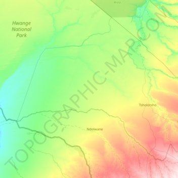
Name: Tsholotsho topographic map, elevation, terrain.
Location: Tsholotsho, Matabeleland North Province, Zimbabwe (-20.19071 26.70203 -19.09668 28.13397)
Average elevation: 1,047 m
Minimum elevation: 941 m
Maximum elevation: 1,370 m
Thank you for supporting this site ❤️
Make a donation
Make a donation