
Cape Dorset topographic map
Interactive map
Click on the map to display elevation.
About this map
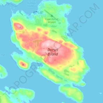
Name: Cape Dorset topographic map, elevation, terrain.
Location: Cape Dorset, Qikiqtaaluk Region, Nunavut, X0A 0C0, Canada (64.17706 -76.58320 64.23963 -76.47187)
Average elevation: 40 m
Minimum elevation: -1 m
Maximum elevation: 229 m