
Vorfrutt topographic map
Interactive map
Click on the map to display elevation.
About this map
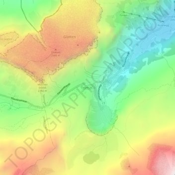
Name: Vorfrutt topographic map, elevation, terrain.
Location: Vorfrutt, Spiringen, Uri, 8751, Schweiz (46.85259 8.85001 46.89259 8.89001)
Average elevation: 2,048 m
Minimum elevation: 1,370 m
Maximum elevation: 2,906 m