
Guejar topographic map
Interactive map
Click on the map to display elevation.
About this map
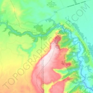
Name: Guejar topographic map, elevation, terrain.
Location: Guejar, Mesetas, Ariari, Meta, Orinoquia, Colombia (3.29430 -74.03071 3.36898 -73.92840)
Average elevation: 644 m
Minimum elevation: 365 m
Maximum elevation: 1,087 m