
Thank you for supporting this site ❤️
Make a donation
Make a donation
Manyoni topographic map
Click on the map to display elevation.
Thank you for supporting this site ❤️
Make a donation
Make a donation
About this map
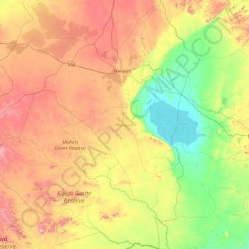
Name: Manyoni topographic map, elevation, terrain.
Location: Manyoni, Singida Region, Central Zone, Tanzania (-6.92686 34.43034 -5.27933 35.35718)
Average elevation: 1,158 m
Minimum elevation: 819 m
Maximum elevation: 1,815 m
Thank you for supporting this site ❤️
Make a donation
Make a donation
Other topographic maps
Click on a map to view its topography, its elevation and its terrain.