
Mabula topographic map
Click on the map to display elevation.
About this map
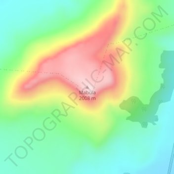
Name: Mabula topographic map, elevation, terrain.
Average elevation: 1,766 m
Minimum elevation: 1,609 m
Maximum elevation: 2,021 m
Other topographic maps
Click on a map to view its topography, its elevation and its terrain.
Mantsopa Ward 2
South Africa > Free State > Thabo Mofutsanyana District Municipality > Mantsopa Local Municipality
Average elevation: 1,583 m
Mantsopa Ward 8
South Africa > Free State > Thabo Mofutsanyana District Municipality > Mantsopa Local Municipality
Average elevation: 1,588 m