
Uchte topographic map
Interactive map
Click on the map to display elevation.
About this map
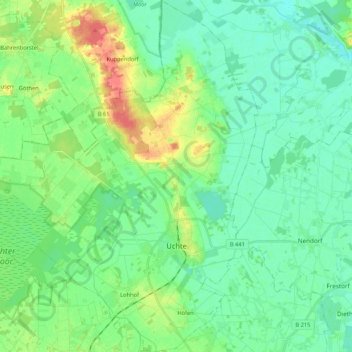
Name: Uchte topographic map, elevation, terrain.
Average elevation: 42 m
Minimum elevation: 27 m
Maximum elevation: 79 m
Other topographic maps
Click on a map to view its topography, its elevation and its terrain.
Holtrup
Deutschland > Niedersachsen > Landkreis Nienburg/Weser > Schweringen
Holtrup, Schweringen, Samtgemeinde Grafschaft Hoya, Landkreis Nienburg/Weser, Niedersachsen, Deutschland
Average elevation: 21 m
Eiße
Deutschland > Niedersachsen > Landkreis Nienburg/Weser > Schweringen
Eiße, Schweringen, Samtgemeinde Grafschaft Hoya, Landkreis Nienburg/Weser, Niedersachsen, 27333, Deutschland
Average elevation: 23 m