
Oldrões topographic map
Interactive map
Click on the map to display elevation.
About this map
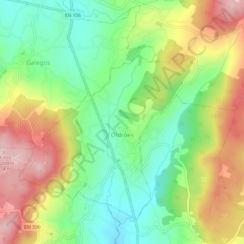
Name: Oldrões topographic map, elevation, terrain.
Location: Oldrões, Penafiel, Porto, Portugal (41.13940 -8.31476 41.16534 -8.27134)
Average elevation: 266 m
Minimum elevation: 159 m
Maximum elevation: 409 m