
Make a donation
Central topographic map
Click on the map to display elevation.
Make a donation
Central
In order to make Quezon's dream a reality and to mobilize funds for the land purchase, the People's Homesite Corporation (PHC) was created on October 14, 1938, as a subsidiary of NDC, with an initial capital of ₱2 million. Roces was the chairman of the Board of PHC, and they immediately acquired the vast Diliman Estate of the Tuason family at a cost of 5 centavos per square meter. PHC conducted topographical and subdivision surveys, and then subdivided the lots and sold them to the target buyers at an affordable price. Its target users and beneficiaries were Manila's working class, who were suffering from a shortage of affordable and decent housing in the capital. The service of the Metropolitan Waterworks system was extended to site. The Bureau of Public Works, then under Secretary Vicente Fragante, constructed the streets and highways within the property. Quezon also tapped Architect Juan M. Arellano to draft a design of the city. Eight vast estates were acquired in order to create Quezon City: Diliman Estate, 1,573.22 hectares (15.7322 km2), Santa Mesa Estate, 861.79 hectares (8.6179 km2), Mandaluyong Estate, 781.36 hectares (7.8136 km2), Magdalena Estate, 764.48 hectares (7.6448 km2), Piedad Estate, 743.84 hectares (7.4384 km2), Maysilo Estate, 266.73 hectares (2.6673 km2) and the San Francisco Del Monte Estate, 257.54 hectares (2.5754 km2). Quezon's goal was to create a place for the working class, coinciding with the planned transfer of the University of the Philippines campus in Manila to a more suitable location, which became another precedent for the creation of Quezon City.
Make a donation
About this map
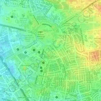
Name: Central topographic map, elevation, terrain.
Average elevation: 50 m
Minimum elevation: 33 m
Maximum elevation: 67 m
Make a donation
Other topographic maps
Click on a map to view its topography, its elevation and its terrain.
La Mesa Dam
The La Mesa was built in Novaliches, which was then still part of the municipality of Caloocan due to the sloping topography of the watershed area from Bulacan. The La Mesa dam later became part of a larger dam system with the opening of the Ipo Dam in Norzagaray, Bulacan in 1936, the Angat Dam in the same…
Average elevation: 65 m
Make a donation
La Mesa Eco Park
Covering an area of 33 hectares (82 acres) the public park is located along the natural boundary of the La Mesa Watershed Reservation and its elevation is about 40 metres (130 ft) below than the resorvoir.
Average elevation: 66 m
Make a donation
Make a donation
Make a donation
La Mesa Dam
The La Mesa was built in Novaliches, which was then still part of the municipality of Caloocan due to the sloping topography of the watershed area from Bulacan. The La Mesa dam later became part of a larger dam system with the opening of the Ipo Dam in Norzagaray, Bulacan in 1936, the Angat Dam in the same…
Average elevation: 65 m
Make a donation