Schweizer-Reneke topographic map
Click on the map to display elevation.
About this map
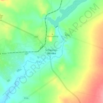
Name: Schweizer-Reneke topographic map, elevation, terrain.
Average elevation: 1,318 m
Minimum elevation: 1,286 m
Maximum elevation: 1,377 m

Click on the map to display elevation.
Name: Schweizer-Reneke topographic map, elevation, terrain.
Average elevation: 1,318 m
Minimum elevation: 1,286 m
Maximum elevation: 1,377 m