
Thank you for supporting this site ❤️
Make a donation
Make a donation
Rweibumba topographic map
Click on the map to display elevation.
Thank you for supporting this site ❤️
Make a donation
Make a donation
About this map
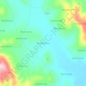
Name: Rweibumba topographic map, elevation, terrain.
Location: Rweibumba, Ntungamo, Western Region, Uganda (-0.98887 30.39006 -0.94887 30.43006)
Average elevation: 1,412 m
Minimum elevation: 1,329 m
Maximum elevation: 1,655 m
Thank you for supporting this site ❤️
Make a donation
Make a donation