
Thank you for supporting this site ❤️
Make a donation
Make a donation
Mupfure river topographic map
Click on the map to display elevation.
Thank you for supporting this site ❤️
Make a donation
Make a donation
About this map
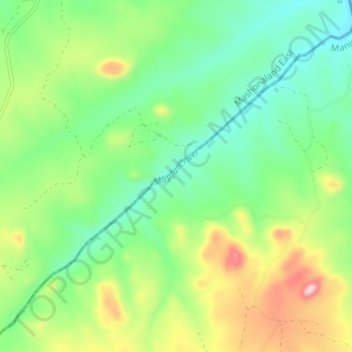
Name: Mupfure river topographic map, elevation, terrain.
Location: Mupfure river, Murehwa, Mashonaland East Province, Zimbabwe (-17.98365 32.08097 -17.92818 32.14748)
Average elevation: 1,217 m
Minimum elevation: 1,106 m
Maximum elevation: 1,436 m
Thank you for supporting this site ❤️
Make a donation
Make a donation