
Thank you for supporting this site ❤️
Make a donation
Make a donation
Calenga topographic map
Click on the map to display elevation.
Thank you for supporting this site ❤️
Make a donation
Make a donation
About this map
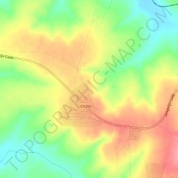
Name: Calenga topographic map, elevation, terrain.
Location: Calenga, Huambo, Angola (-12.95333 15.31333 -12.91333 15.35333)
Average elevation: 1,497 m
Minimum elevation: 1,447 m
Maximum elevation: 1,544 m
Thank you for supporting this site ❤️
Make a donation
Make a donation