
Caldas da Rainha topographic map
Interactive map
Click on the map to display elevation.
About this map
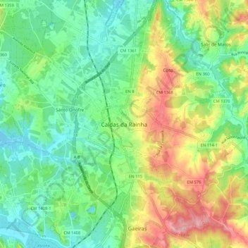
Name: Caldas da Rainha topographic map, elevation, terrain.
Location: Caldas da Rainha, CLD, Leiria, West, Mitte, 2500-253, Portugal (39.36721 -9.17460 39.44721 -9.09460)
Average elevation: 58 m
Minimum elevation: -4 m
Maximum elevation: 164 m