
Thank you for supporting this site ❤️
Make a donation
Make a donation
Fungurume topographic map
Click on the map to display elevation.
Thank you for supporting this site ❤️
Make a donation
Make a donation
About this map
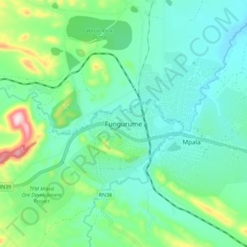
Name: Fungurume topographic map, elevation, terrain.
Location: Fungurume, Lubudi, Lualaba, Democratic Republic of the Congo (-10.65657 26.27662 -10.57657 26.35662)
Average elevation: 1,216 m
Minimum elevation: 1,135 m
Maximum elevation: 1,485 m
Thank you for supporting this site ❤️
Make a donation
Make a donation