
Ahusen topographic map
Interactive map
Click on the map to display elevation.
About this map
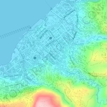
Name: Ahusen topographic map, elevation, terrain.
Location: Ahusen, Ambon, Moluccas, Maluku, Indonesia (-3.70358 128.17899 -3.69622 128.18542)
Average elevation: 47 m
Minimum elevation: 0 m
Maximum elevation: 223 m
Other topographic maps
Click on a map to view its topography, its elevation and its terrain.