
Thank you for supporting this site ❤️
Make a donation
Make a donation
Garland topographic map
Click on the map to display elevation.
Thank you for supporting this site ❤️
Make a donation
Make a donation
About this map
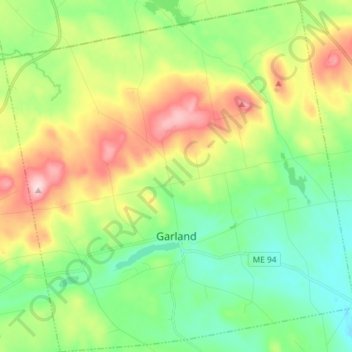
Name: Garland topographic map, elevation, terrain.
Location: Garland, Penobscot County, Maine, 04939, United States (45.00444 -69.23202 45.10720 -69.08623)
Average elevation: 154 m
Minimum elevation: 65 m
Maximum elevation: 317 m
Thank you for supporting this site ❤️
Make a donation
Make a donation
Other topographic maps
Click on a map to view its topography, its elevation and its terrain.
Thank you for supporting this site ❤️
Make a donation
Make a donation
Thank you for supporting this site ❤️
Make a donation
Make a donation