
Thank you for supporting this site ❤️
Make a donation
Make a donation
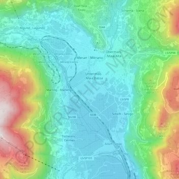
Meran - Merano topographic map
Click on the map to display elevation.
Thank you for supporting this site ❤️
Make a donation
Make a donation
Meran - Merano
The average daily temperatures in summer in Merano lie between 27 and 30 °C, while at night temperatures usually drop to between 12 and 15 °C. The average daily temperatures in winter lie between 6 and 10 °C, while at night temperatures usually drop to between -4 and -2 °C. The wettest month is August with 96 mm, while the driest is February with only 25 mm. This data was measured at the weather station Merano/Gratsch at an altitude of 333 metres between 1983 and 2017.
Thank you for supporting this site ❤️
Make a donation
Make a donation
About this map
Name: Meran - Merano topographic map, elevation, terrain.
Average elevation: 635 m
Minimum elevation: 255 m
Maximum elevation: 1,790 m
Thank you for supporting this site ❤️
Make a donation
Make a donation