
Laguna del Campillo topographic map
Interactive map
Click on the map to display elevation.
About this map
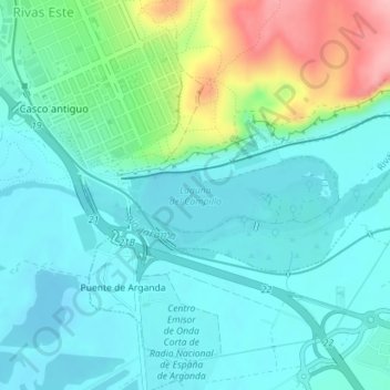
Name: Laguna del Campillo topographic map, elevation, terrain.
Average elevation: 556 m
Minimum elevation: 524 m
Maximum elevation: 663 m
Other topographic maps
Click on a map to view its topography, its elevation and its terrain.
Cuerda Larga
España > Comunidad de Madrid > Arganda del Rey
Cuerda Larga, Arganda del Rey, Cuenca del Henares, Comunidad de Madrid, 28500 ARGANDA DEL REY, España
Average elevation: 705 m