
Thank you for supporting this site ❤️
Make a donation
Make a donation
Bad Emstal topographic map
Click on the map to display elevation.
Thank you for supporting this site ❤️
Make a donation
Make a donation
About this map
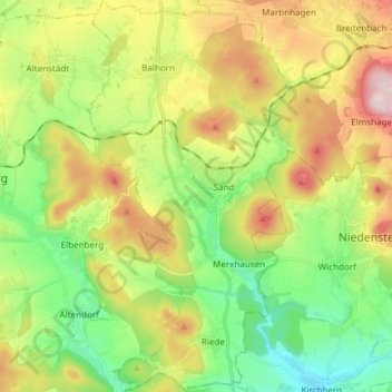
Name: Bad Emstal topographic map, elevation, terrain.
Location: Bad Emstal, Landkreis Kassel, Hessen, 34308, Duitsland (51.19589 9.20728 51.29023 9.30914)
Average elevation: 319 m
Minimum elevation: 189 m
Maximum elevation: 519 m
Thank you for supporting this site ❤️
Make a donation
Make a donation