
Thank you for supporting this site ❤️
Make a donation
Make a donation
Frades topographic map
Click on the map to display elevation.
Thank you for supporting this site ❤️
Make a donation
Make a donation
About this map
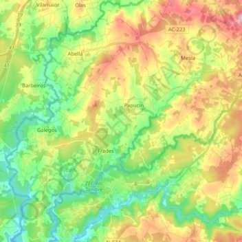
Name: Frades topographic map, elevation, terrain.
Location: Frades, Ordes, A Coruña, Galicië, 15686, Spanje (42.99998 -8.35598 43.09911 -8.19606)
Average elevation: 352 m
Minimum elevation: 258 m
Maximum elevation: 489 m
Thank you for supporting this site ❤️
Make a donation
Make a donation
Other topographic maps
Click on a map to view its topography, its elevation and its terrain.