
District of Nové Zámky topographic map
Interactive map
Click on the map to display elevation.
About this map
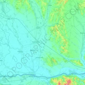
Name: District of Nové Zámky topographic map, elevation, terrain.
Average elevation: 142 m
Minimum elevation: 102 m
Maximum elevation: 623 m
Other topographic maps
Click on a map to view its topography, its elevation and its terrain.
Chľaba
Slovakia > Region of Nitra > District of Nové Zámky
Chľaba, District of Nové Zámky, Region of Nitra, Western Slovakia, 943 66, Slovakia
Average elevation: 168 m