
Thank you for supporting this site ❤️
Make a donation
Make a donation
Carreira topographic map
Click on the map to display elevation.
Thank you for supporting this site ❤️
Make a donation
Make a donation
About this map
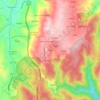
Name: Carreira topographic map, elevation, terrain.
Average elevation: 335 m
Minimum elevation: 160 m
Maximum elevation: 458 m
Thank you for supporting this site ❤️
Make a donation
Make a donation
Other topographic maps
Click on a map to view its topography, its elevation and its terrain.
Fragas de São Simão
Portugal > Leiria > Figueiró dos Vinhos > Aguda > Ponte de São Simão
Average elevation: 357 m
Thank you for supporting this site ❤️
Make a donation
Make a donation