
Am Großen Bruch topographic map
Interactive map
Click on the map to display elevation.
About this map
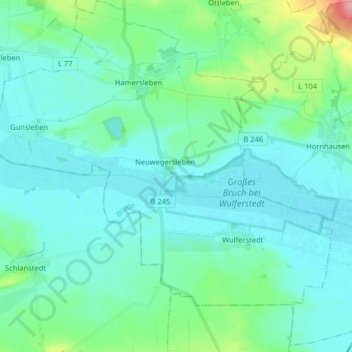
Name: Am Großen Bruch topographic map, elevation, terrain.
Average elevation: 97 m
Minimum elevation: 77 m
Maximum elevation: 197 m
Other topographic maps
Click on a map to view its topography, its elevation and its terrain.
Mahlwinkel
Duitsland > Saksen-Anhalt > Börde > Angern
Mahlwinkel, Angern, Elbe-Heide, Börde, Saksen-Anhalt, Duitsland
Average elevation: 42 m