
South Pond topographic map
Interactive map
Click on the map to display elevation.
About this map
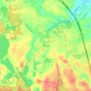
Name: South Pond topographic map, elevation, terrain.
Average elevation: 38 m
Minimum elevation: 1 m
Maximum elevation: 71 m
Other topographic maps
Click on a map to view its topography, its elevation and its terrain.
Manomet Beach
United States > Massachusetts > Plymouth County > Plymouth
Manomet Beach, Plymouth, Plymouth County, Massachusetts, United States
Average elevation: 7 m
Ellisville
United States > Massachusetts > Plymouth County > Plymouth
Ellisville, Plymouth, Plymouth County, Massachusetts, United States
Average elevation: 17 m
East Carver
United States > Massachusetts > Plymouth County > Plymouth
East Carver, Plymouth, Plymouth County, Massachusetts, 02330, United States
Average elevation: 43 m
Nameloc Heights
United States > Massachusetts > Plymouth County > Plymouth
Nameloc Heights, Plymouth, Plymouth County, Massachusetts, 02562, United States
Average elevation: 19 m