
Watrange topographic map
Interactive map
Click on the map to display elevation.
About this map
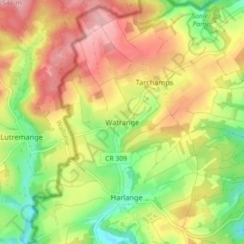
Name: Watrange topographic map, elevation, terrain.
Location: Watrange, Lac de la Haute-Sûre, Canton Wiltz, 9690, Luxembourg (49.92372 5.76653 49.96372 5.80653)
Average elevation: 468 m
Minimum elevation: 396 m
Maximum elevation: 538 m