
Thank you for supporting this site ❤️
Make a donation
Make a donation
Greendale topographic map
Click on the map to display elevation.
Thank you for supporting this site ❤️
Make a donation
Make a donation
About this map
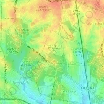
Name: Greendale topographic map, elevation, terrain.
Location: Greendale, Saint Louis County, Missouri, United States (38.68793 -90.31704 38.69949 -90.30896)
Average elevation: 184 m
Minimum elevation: 161 m
Maximum elevation: 206 m
Thank you for supporting this site ❤️
Make a donation
Make a donation