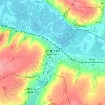
Longpré-les-Corps-Saints topographic map
Interactive map
Click on the map to display elevation.
About this map
Name: Longpré-les-Corps-Saints topographic map, elevation, terrain.
Average elevation: 41 m
Minimum elevation: 2 m
Maximum elevation: 99 m

Click on the map to display elevation.
Name: Longpré-les-Corps-Saints topographic map, elevation, terrain.
Average elevation: 41 m
Minimum elevation: 2 m
Maximum elevation: 99 m