
Thank you for supporting this site ❤️
Make a donation
Make a donation
Redland Bay topographic map
Click on the map to display elevation.
Thank you for supporting this site ❤️
Make a donation
Make a donation
About this map
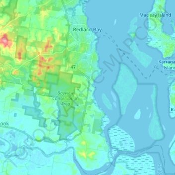
Name: Redland Bay topographic map, elevation, terrain.
Location: Redland Bay, Redland City, Queensland, Australia (-27.71056 153.25694 -27.59317 153.32453)
Average elevation: 17 m
Minimum elevation: -2 m
Maximum elevation: 205 m
Thank you for supporting this site ❤️
Make a donation
Make a donation
Other topographic maps
Click on a map to view its topography, its elevation and its terrain.