
Lakeside Park topographic map
Interactive map
Click on the map to display elevation.
About this map
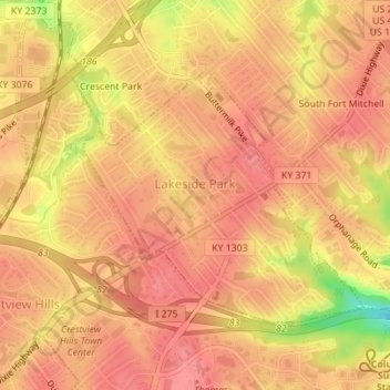
Name: Lakeside Park topographic map, elevation, terrain.
Location: Lakeside Park, Kenton County, Kentucky, 41017, United States (39.02600 -84.57911 39.04356 -84.55411)
Average elevation: 255 m
Minimum elevation: 199 m
Maximum elevation: 273 m