
Whiteriver topographic map
Interactive map
Click on the map to display elevation.
About this map
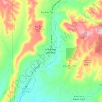
Name: Whiteriver topographic map, elevation, terrain.
Location: Whiteriver, Navajo County, Arizona, 85941, United States (33.79699 -110.00427 33.87699 -109.92427)
Average elevation: 1,701 m
Minimum elevation: 1,513 m
Maximum elevation: 1,994 m
Other topographic maps
Click on a map to view its topography, its elevation and its terrain.
Three Sisters
United States > Arizona > Navajo County
Three Sisters, Navajo County, Arizona, United States
Average elevation: 1,664 m