
Achterbroek topographic map
Interactive map
Click on the map to display elevation.
About this map
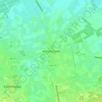
Name: Achterbroek topographic map, elevation, terrain.
Location: Achterbroek, Kalmthout, Antwerpen, Vlaanderen, 2920, België (51.37722 4.48068 51.41722 4.52068)
Average elevation: 18 m
Minimum elevation: 12 m
Maximum elevation: 24 m
Other topographic maps
Click on a map to view its topography, its elevation and its terrain.