
Thank you for supporting this site ❤️
Make a donation
Make a donation
Steuben County topographic map
Click on the map to display elevation.
Thank you for supporting this site ❤️
Make a donation
Make a donation
About this map
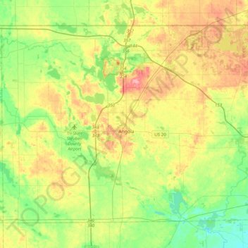
Name: Steuben County topographic map, elevation, terrain.
Location: Steuben County, Indiana, United States (41.52644 -85.19662 41.76022 -84.80469)
Average elevation: 304 m
Minimum elevation: 264 m
Maximum elevation: 364 m
Thank you for supporting this site ❤️
Make a donation
Make a donation
Other topographic maps
Click on a map to view its topography, its elevation and its terrain.