
Le Polucan topographic map
Interactive map
Click on the map to display elevation.
About this map
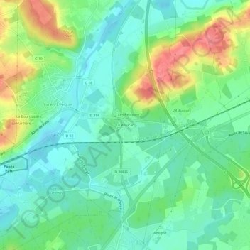
Name: Le Polucan topographic map, elevation, terrain.
Average elevation: 68 m
Minimum elevation: 44 m
Maximum elevation: 117 m
Other topographic maps
Click on a map to view its topography, its elevation and its terrain.
Bener
France > Pays de la Loire > Sarthe > Yvré-l'Évêque
Bener, Yvré-l'Évêque, Le Mans, Sarthe, Pays de la Loire, France métropolitaine, 72530, France
Average elevation: 74 m