
Groendal topographic map
Click on the map to display elevation.
About this map
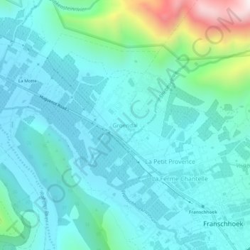
Name: Groendal topographic map, elevation, terrain.
Average elevation: 353 m
Minimum elevation: 201 m
Maximum elevation: 1,093 m
Other topographic maps
Click on a map to view its topography, its elevation and its terrain.
Eerste River
South Africa > Western Cape > Cape Winelands District Municipality > Stellenbosch Local Municipality
Average elevation: 379 m