
Cote topographic map
Interactive map
Click on the map to display elevation.
About this map
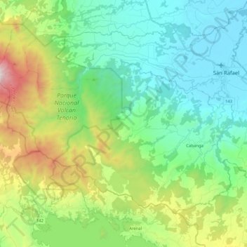
Name: Cote topographic map, elevation, terrain.
Location: Cote, Cantón Guatuso, Provincia Alajuela, 21503, Costa Rica (10.55454 -85.01969 10.70351 -84.81482)
Average elevation: 500 m
Minimum elevation: 39 m
Maximum elevation: 1,722 m