
Alvorninha topographic map
Interactive map
Click on the map to display elevation.
About this map
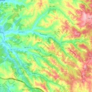
Name: Alvorninha topographic map, elevation, terrain.
Location: Alvorninha, Caldas da Rainha, Leiria, Oeste, Centre, Portugal (39.35945 -9.08384 39.42362 -8.98250)
Average elevation: 121 m
Minimum elevation: 31 m
Maximum elevation: 238 m