
Thank you for supporting this site ❤️
Make a donation
Make a donation
Tsitsamura topographic map
Click on the map to display elevation.
Thank you for supporting this site ❤️
Make a donation
Make a donation
About this map
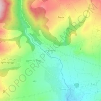
Name: Tsitsamura topographic map, elevation, terrain.
Location: Tsitsamura, Dusheti Municipality, Mtskheta-Mtianeti, Georgia (42.01347 44.57022 42.05347 44.61022)
Average elevation: 834 m
Minimum elevation: 697 m
Maximum elevation: 1,044 m
Thank you for supporting this site ❤️
Make a donation
Make a donation
Other topographic maps
Click on a map to view its topography, its elevation and its terrain.
Pasanauri
Georgia > Mtskheta-Mtianeti > Dusheti Municipality
Pasanauri lies about 90 kilometres (56 mi) north of the nation's capital of Tbilisi, at elevation of 1,050 m. above sea level. Located on the Georgian Military Road, Pasanauri is flanked by the Aragvi River, and surrounded by the Caucasus Mountains. Average winter temperature is 0 degrees Celsius, but often…
Average elevation: 1,507 m
Thank you for supporting this site ❤️
Make a donation
Make a donation