
Thank you for supporting this site ❤️
Make a donation
Make a donation
Chester topographic map
Click on the map to display elevation.
Thank you for supporting this site ❤️
Make a donation
Make a donation
About this map
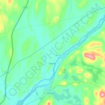
Name: Chester topographic map, elevation, terrain.
Location: Chester, Penobscot County, Maine, 04457, United States (45.35781 -68.60469 45.49454 -68.36952)
Average elevation: 89 m
Minimum elevation: 44 m
Maximum elevation: 267 m
Thank you for supporting this site ❤️
Make a donation
Make a donation
Other topographic maps
Click on a map to view its topography, its elevation and its terrain.
Thank you for supporting this site ❤️
Make a donation
Make a donation
Thank you for supporting this site ❤️
Make a donation
Make a donation