
Thank you for supporting this site ❤️
Make a donation
Make a donation
Bierstetten topographic map
Click on the map to display elevation.
Thank you for supporting this site ❤️
Make a donation
Make a donation
About this map
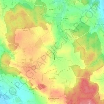
Name: Bierstetten topographic map, elevation, terrain.
Average elevation: 649 m
Minimum elevation: 593 m
Maximum elevation: 700 m
Thank you for supporting this site ❤️
Make a donation
Make a donation
Other topographic maps
Click on a map to view its topography, its elevation and its terrain.
Lampertsweiler
Deutschland > Baden-Württemberg > Landkreis Sigmaringen > Bad Saulgau
Average elevation: 617 m
Heratskirch
Deutschland > Baden-Württemberg > Landkreis Sigmaringen > Bad Saulgau
Average elevation: 658 m