
Itharna topographic map
Interactive map
Click on the map to display elevation.
About this map
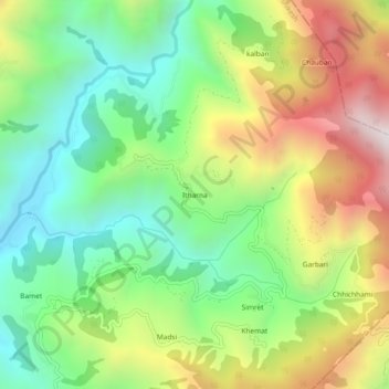
Name: Itharna topographic map, elevation, terrain.
Location: Itharna, Rishikesh, Dehradun, Uttarakhand, India (30.22374 78.25134 30.26374 78.29134)
Average elevation: 1,174 m
Minimum elevation: 709 m
Maximum elevation: 1,888 m
Other topographic maps
Click on a map to view its topography, its elevation and its terrain.
Thano
India > Uttarakhand > Rishikesh
Thano, Rishikesh, Dehradun District, Uttarakhand, 248143, India
Average elevation: 748 m
ladwakot
India > Uttarakhand > Rishikesh
ladwakot, Rishikesh, Dehradun, Uttarakhand, India
Average elevation: 1,305 m
Rishikesh
India > Uttarakhand > Rishikesh
Rishikesh, Dehradun, Uttarakhand, 249201, India
Average elevation: 497 m